Indonesia Map – Cities and Roads
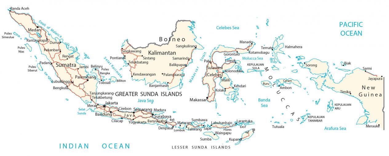
A map of Indonesia that contains cities, towns, highways, and islands. From its mountains to its coastal plains, satellite imagery, and a physical map show the topography.
Indonesia map collection


About the map
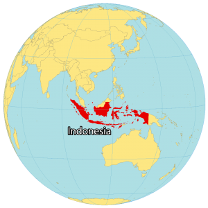
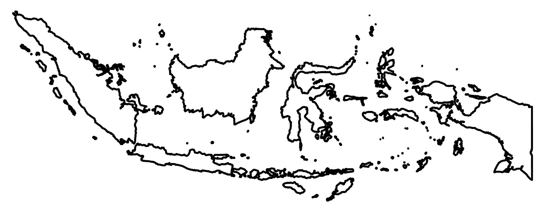
Indonesia is an archipelago in southeast Asia next to the Indian and Pacific Oceans. In fact, it’s the largest archipelago in the world consisting of over 17,500 islands. While five are major islands, 6000 are uninhabited.
The country has the fourth-highest population in the world, after China, India, and the United States. Indonesia is also an internationally divided island with Papua New Guinea and East Timor. It’s also very close to Brunei, Singapore, and Malaysia in the north, as well as Australia in the south.
With a population of over 276 million people, Indonesia is the fourth most populous country in the world. The majority of the population is concentrated on the island of Java, which is home to the capital city of Jakarta. Other major cities in Indonesia include Surabaya, Bandung, and Bali.
You are free to use our Indonesia map for educational and commercial uses. Attribution is required. How to attribute?
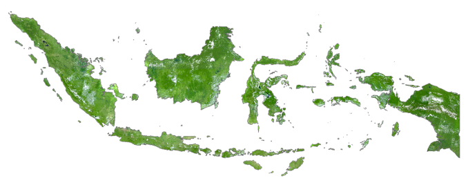
SATELLITE IMAGERY
Indonesia Satellite Map
The five main islands of Indonesia are Sumatra, Java, Kalimantan (Indonesian Borneo), Sulawesi, and Papua (the Indonesian section of New Guinea). But the archipelago contains thousands of islands in the surrounding area.
Altogether, Indonesia occupies an area of 8,063,601 square kilometers (3,113,374 sq mi). Indonesia is home to the world’s third-largest area of rainforest after the Amazon and Africa’s Congo Basin. As part of the rainforest habitat, they serve as some of the highest biodiverse regions in the world.
PHYSICAL MAP
Indonesia Physical Map
Indonesia is a mix of coastal plains with some mountainous areas within the interior of its islands. For example, the islands of Sumatra, Borneo, and Papua contain the Barisan, Kapuas, and Maoke Mountains.
At 4,884 m (16,024 ft) in height, Puncak Jaya (Mount Jayawijaya) is the highest mountain in Indonesia on the island of New Guinea. Many of the mountainous areas in Indonesia are active volcanoes, such as Mount Merapi on the island of Java.
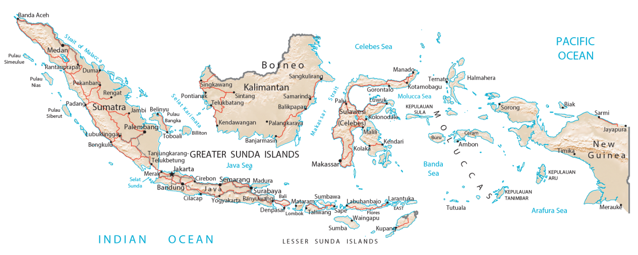
Capital City
Jakarta
Major islands
Bali
Borneo
Greater Sunda Islands
Java
Lesser Sunda Islands
Moluccas Islands
New Guinea
Sulawesi (Celebes)
Sumatra
Major cities
Balikpapan
Banjarmasin
Bandung
Bandar Lampung
Denpasar
Jambi
Makassar
Manado
Medan
Padang
Palembang
Pekanbaru
Samarinda
Semarang
Surabaya
Islands and archipelagos
Aru Islands
Billiton
Buru
Ceram
Flores Island
Halmahera
Kalimantan
Kepulauan Sula
Pulau Bangka
Pulau Nias
Pulau Siberut
Pulau Simeulue
Sumba Island
Sumbawa
Tanimbar Islands
Tutuala Island
Seas, straits and water
Arafura Sea
Banda Sea
Celebes Sea
Indian Ocean
Java Sea
Makassar Strait
Molucca Sea
Pacific Ocean
Selat Karimata
Selat Sunda
Strait of Malacca
Strait Sunda
Populated places
Ambon
Banda Aceh
Banyuwangi
Belinyu
Bengkulu
Biak
Cilacap
Cirebon
Duma
Gorontalo
Jayapura
Kendari
Kendawangan
Kolaka
Kolonodale
Kotamobagu
Kupang
Labuhanbajo
Larantuka
Lombok
Lubuklinggau
Luwuk
Madura
Malili
Mataram
Merak
Merauke
Palangkaraya
Palu
Pontianak
Rantauprapat
Rengat
Sangkulirang
Sape
Sarmi
Singkawang
Sintang
Sorong
Taliwang
Tanjungkarang-Telukbetung
Telukbatang
Ternate
Timika
Toboali
Waingapu
Yogyakarta


Make political map of Indonesia please, with 38 provinces (and maybe the future capital IKN)